Advanced solutions to elevate decision making at the mine site.
Scale you higher-flows of data processing with an enterprise grade, on-prem solution and empower your geospatial workflow by harnessing the power of our in-house photogrammetry engine, streamlining processing queues, and securing your valuable data in the Cloud¹.
Whether your operations are at remote locations with challenging connectivity conditions or you are looking to standardize your geospatial data generation for your different teams and consolidate in the Cloud¹ for auditing purposes, EdgeServe is ideal for mining organizations that are ready to scale their geospatial operations.
¹Cloud Sync requires the EdgeServer to be connected to an internet connection. Upload processing will vary depending on available bandwidth

Elevate your organization capabilities with the most efficient and convenient solution for automated data processing in the Cloud to enable your teams to focus on what matters most, decision making.
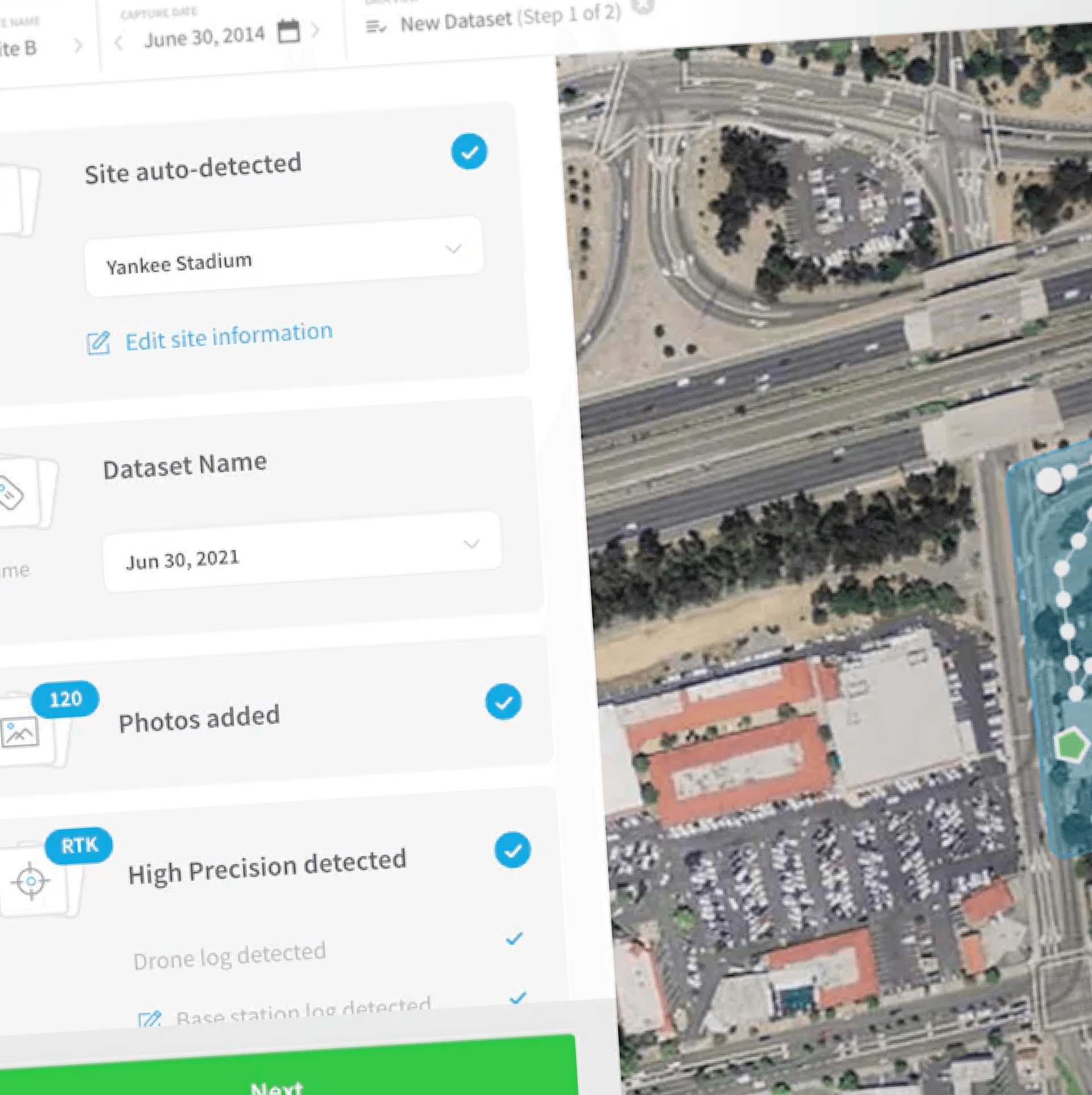
Handling high-flows of data has never been easier by leveraging parallel processing the data coming from the field, whether from images or LiDAR, simply drag and drop the raw data, use our optimized processing settings for mining and that's it.
You will receive a notification as soon as the results are ready for consumption. Integrate directly with third party solutions for downstream applications and workflows.

Generating clean and accurate surface models has never been easier with our AI and Deep Learning applications. Automatically remove vegetation, machinery, personnel and other artifacts from each 3D model, producing clean data without manual steps.

Our suite of Machine Learning and AI tools automatically detect, extract and output a range of critical physical elements from mine sites, such as toes & crests, safety berms, haul roads and more. Automatically extract value from processed data without time consuming manual steps.

Automatically merge multiple data sources to create a master 3D mesh in order to provide total site visibility with the most up to date data.
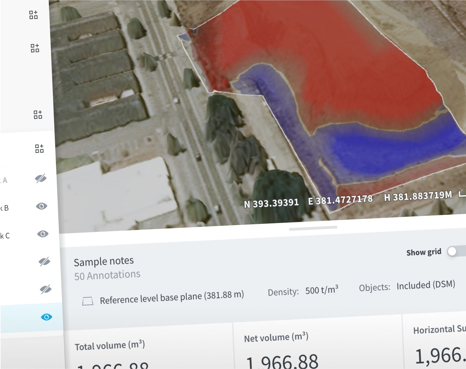
Experience accuracy, consistency and reliability every time with our survey-grade measurements, which provide the foundation for confident decision making.
The Skycatch solution reduces our time to obtain high accuracy 3D data by 60% versus traditional photogrammetry. We are able to capture 3x the area with Skycatch in 10-15 minutes compared to 3 hours with a laser scan. And, with no blind spots! Safety is a priority for us and reducing the exposure of personnel in the mine has been a tremendous benefit.
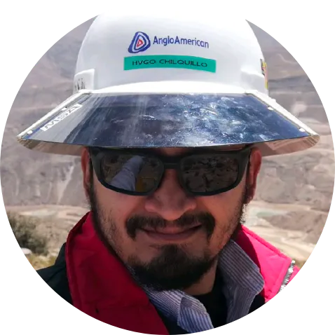
Hugo Padilla
Mine Engineer & Lead Surveyor in Quellaveco, Peru